Accueil
World
NEW
Premium
Shop
Randonnées
Articles
Aide - support
Français
English
Nederlands
Español
Italiano
Deutsch
Connexion
Accueil
World
Premium
Shop
Randonnées
Articles
Aide - support
SityTrail
>
Points d'intérêt
>
Cliffs of Moher
SityTrail
>
Points d'intérêt
>
Cliffs of Moher
Cliffs of Moher
Description
Photos
Cliffs of Moher est à découvrir dans les randonnées suivantes...
gpstracks
a-engeland-rondje-ierland-2009
Moteur
Très facile
Douvres, Angleterre, Kent, Royaume-Uni
3486 km | 4396 km-effort
Inconnu
Non
gpstracks
Utilisateur
©
OpenStreetMap
contributors
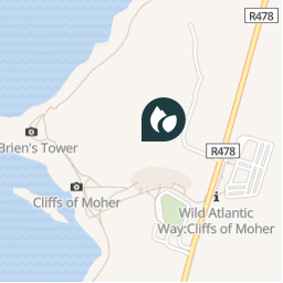
Localisation
Pays :
Irlande
Région :
Inconnu
Département/Province :
County Clare
Commune :
West Clare Municipal District
Localité :
Ballysteen
Localisation
52.9728598 / -9.4265878
Date de création :
2018-04-10 21:44:59.051
Dernière modification
2018-04-10 21:44:59.051
(0 Avis)
Commentaires
Veuillez vous connecter pour laisser un commentaire ou une note
Points d'intérêt à proximité
walter.hmcampbell
Cowslip
WEST CLARE MUNICIPAL DISTRICT
walter.hmcampbell
Start
WEST CLARE MUNICIPAL DISTRICT
walter.hmcampbell
Tomb
WEST CLARE MUNICIPAL DISTRICT
walter.hmcampbell
Turn
WEST CLARE MUNICIPAL DISTRICT
walter.hmcampbell
Mullagh
WEST CLARE MUNICIPAL DISTRICT
walter.hmcampbell
OffSlope
WEST CLARE MUNICIPAL DISTRICT
walter.hmcampbell
TurnSteps
WEST CLARE MUNICIPAL DISTRICT
walter.hmcampbell
Knockanes
WEST CLARE MUNICIPAL DISTRICT
Fermer
Mes abonnements